
See here for the first part of Section I.
Parts of Section I get side eyed far too much. Most are happy to walk the second half of it from Chinook Pass on Hwy 410 to Government Meadows (reached via FS 70 out of the village of Greenwater, off of Hwy 410) but sigh as if the remainder of this section is just below them. Yes, it is the infamous ancient clearcuts and views are low. However it offers something you could overlook: So much silence. It is lonely back there. Unlike the “pretty” areas of the PCT, this is where the trail is for the miles. The wind, the birds, the butterflies. Open skies and trail devoid of trees for miles, yet rich in blueberries and huckleberries – and of mushrooms.
I first hiked this section in 2003 and hiked much of it in sections, some in a long day. (I hiked from Snoqualmie Pas to Stampede Pass as a 18.5 mile dayhike) The pictures cover many points in the seasons.
Starting at Chinook Pass, the trail is just above the parking lot, with many side trails to get up to it. The parking lot is ample, as it is a popular pullout for tourists and the hike to Sheep Lake. For the first mile or so, the trail follows above Hwy 410, but you don’t notice the traffic below. The views pull you in, across the way, of the peaks and the American River valley below.
The trail turns and leaves the highway, leaving the sun drenched hillside behind. The trail flits through subalpine forest and open stretches.

With views periodically of the peaks and the little meadows below the trail. Eventually the trail comes up to the lake basin for Sheep Lake.

Sheep Lake is super popular. It’s pretty, huge and has tons of campsites hidden all around the lake basin. The water is easy to get to, and wading is easy in the shallow, sun warmed water.. Trails go all the way around the lake.

Walk around the lake to the right and enjoy the views.

Stay on the main path and the trail will leave the lake and slowly climb up the ridge in front of you. Sourdough Gap is the goal (the low point in the ridge above).
At Sourdough Gap you will get a great view of below and 360 around you.

Looking down from the Gap, as the trail takes off North. The trail has a junction just beyond Sourdough Gap, to another Gap. If you want a great view of Mount Rainier, take the upper trail.

The view from the Gap, if you choose to take the short side trail. It is the back door entrance to Upper Crystal Lake. You enter Mount Rainier NP at this gap. The trail goes over the gap a bit more down, and you can look down to the lake (it’s an easy enough hike down to the lake, though the trail winds around a bit to get there).
Back on the trail this section walks along the crest, just below give or take for awhile. It’s never hard, and the views to Eastern Washington are pleasant.

In early Fall the hillsides are brilliant with color from Sourdough Gap on.

At Bear Gap. The trail crosses over towards the Crystal Mountain Basin, where the ski resort is.

Looking across the vast Crystal Basin. The trail winds around above treeline with never ending views as it passes Crown Point.

Below is Pickhandle Basin and Bullion Basin (BB has excellent camping, down side trails, though it is a steep drop down).

The trail continues below the ridge, above the forest, to Scout Pass. Take a look at Rainier and go over the top.

There is a side trail worth taking at Scout Pass to Norse Peak, if one has time. There are a couple ways to Norse Peak, study the maps.

The trail heads downhill and traverses the hillside as it wraps away from Scout Pass.

Looking across the way to the many side paths that cross over from Crystal to lakes and hunting areas.

Little skull above Big Crow Basin.

Hiking in the snow on Labor Day one weekend.

Big Crow Basin, one trip we saw over 100 Elk getting ready to bed down.

Looking across the basin at the shelter in the trees.

The ancient shelter at Big Crow Basin.

Tents in the trees, a bit away from the shelter one year.
Get water in Big Crow Basin. It will be many miles till you see it again.

The trails pull up and traverses the hill side towards Little Crow Basin, below the trail. the views across are mesmerizing in how remote you feel back here. The trail turns in at Hayden Pass, and passes meadows that a dry camp could be done in. Martinson Gap, and the miles wile away, just a quiet trail with little but the wind to make noise.

I don’t remember exactly where this was, but I have hiked by it twice.

The trail turns, taking the easiest way, when it can.

The sections above these areas is near.

Walking through a subalpine forest and then it flits back to the eastern crest with really cool erosion.

The massive meadow below the trail, reached by a short trail, to the long ago plane wreck left behind. There is a sign for “Airplane Meadow”. The trail beyond it goes down far below to Echo Lake.

Having passed Arch Rock a couple of times, I have never been down the side trail. It does usually have water near here, at the Arch Rock Spring that flows. Supposedly it offers camping down the side trail, which is .5 a mile long.

At the end of FS 70, from Hwy 410, the road ends and an old FS logging road takes one quickly to the PCT. End of the trail marker that is passed, .5 a mile to Government Meadows.

Government Meadows (there are a couple, and they are huge and relatively flat).

The trail comes out of the forest to Urich Cabin. There is often water here: get all you will need for many miles.

Urich cabin: about the best thing you might ever see on the PCT, in Washington State.

The cabin is huge and well taken care of.

Just remember to be cool there.

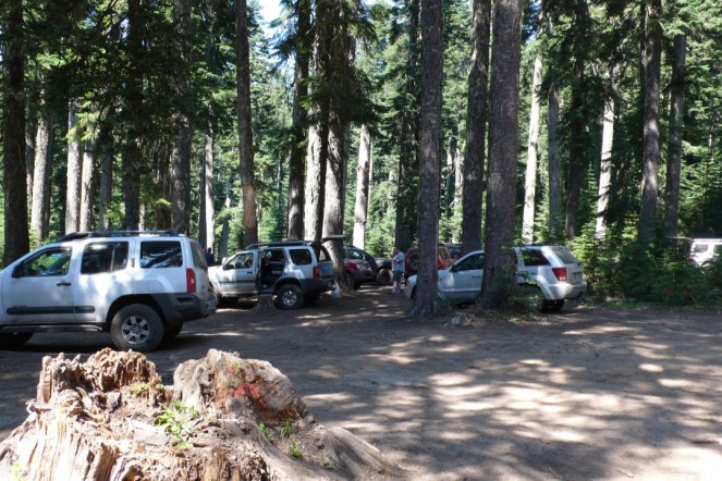
Just know that with this comes to the first road crossing in many miles. Just a bit away the Naches Jeep Trail crosses over, with a huge dirt parking lot in the trees.
Keep walking and it quickly melts away.

Enjoy this short section in the trees.
For it starts soon.
The trail comes out to FS road and the forest is gone. Put your sunhat on and tuck in your belt. It isn’t glorious. But it will be lonely. Pyramid Peak is the next goal, then Blowout Mountain.
There is a couple trail referred in guides for camping at Blowout. I have been down the one north of Blowout, and camped there. Trust none others listed. If you find them, great. But yes, the trail north is good and there is a small creek and a lake a bit father along that offers excellent camping. A shot of the meadows on the eastern side of Blowout.

From there the trail winds up and down, through sections of deep forest, to vast clearcuts. Crossing old, long shut down FS roads. Water is sparing, so if you see any, fill up. We passed on tiny creeklet in early fall and had to use a cup to collect water.
One section was so lonely. All one could see was a maze of old roads and the trail bumped up to an end of the road turnaround for logging trucks. And it was so intensely silent back there.

Sometimes the trail would be marked with PCT markers in trees, other times it was this.

Or chainsawed in.
Tacoma Pass was the first “road road” we crossed, and it felt so odd.
Approaching Stampede Pass, after many pointless climbs, you will see high power lines. Cross under them, and then 2 more sections of them. Finally Stampede Pass shows up. Lizard Lake is nearby if needed. Stampede is a busy place, though it isn’t fast to reach (one has to drive far across Snoqualmie Pass on I-90 then backtrack on a long dusty FS road to get there).

And up the ridge you go. At the top you can see I-90 stretching far into Eastern Washington. Walk this section at night and you will hear coyotes and elk for hours.
The first part of this section will remind you of the last section. Clearcuts and forests. Cutting back and forth, crossing old FS roads. It does get better eventually.

Looking down at Twilight Lake and the end of the clearcuts up high. That is where you are going. From this viewpoint, you can look down into the Cedar River and far, far down into the maze of roads that go into the water shed.

Twilight Lake, the headwater of the Cedar River. The lake can be walked out to, tread carefully as parts of it are a wetland.

And old road goes by the lake and crosses Yakima Pass, elevation 3575. At the start of Chinook Pass it is in the mid 5,000’s.

Entering the top of the ridge, looking down at another small lake and in the far distance where you have come from.

It is jarring once you slip into the woods, where the forest hasn’t been messed with.

Mirror Lake, a gorgeous mid elevation lake that calls to sit down by, but if you want to get to dinner…head down and keep walking.

The views are plentiful as you wind around the ridges, in and out of the trees. It’s a relaxing hike here.

Small ponds near Silver Peak.
The trail winds up to the parking lot for Silver Peak TH. through the one awkward old clear cut. It boasts great berry fields.

And just a bit farther north at Ollalie Meadow.

Looking across towards Granite Peak.

Water is plentiful on this section, often passing tiny creeklets of water, even in September. The berries are thick in early fall.

Looking across to Granite Mountain, with its lookout tower at the far top.

Crossing over and looking down and to the west of the ribbon of I-90. Below is the Iron Horse Trail and the tunnel under Snoqualmie Pass. You will also walk under power lines again. Just as before.

An old Cascade Crest Trail sign that isn’t exactly up to date.

The trail winds down to Lodge Lake.

Then bounces up quickly to Beaver Lake at the top of the ridge.

Red Mountain in the far distance. I-90 is below and Snoqualmie Pass is but a mile or two more….with food and lodging. If you are heading to the town part, rather than the parking lot, as you are about to reenter the forest, take the ski resort cat road down and leave the PCT.

Accurate? Maybe, maybe not.
But the section is done. And that counts for something. If you are not getting picked up in this remote parking area, walk down the dirt “road” (it is just this really wide back lot that serves as a road) into town.
And remind yourself you will never need to hike from Government Meadows to Twilight Lake hopefully ever again. And mark that bucket all done……
And remember that just across the way, the PCT picks up to do the most amazing section…..
~Sarah