
If there is a section of the Pacific Crest Trail that is seen as the pinnacle of Washington State, it may well be Section J, which is between I-90 at Snoqualmie Pass and to Highway 2 at Stevens Pass. We choose to hike southbound to make getting home faster. The section spends much of it in subalpine splendor, with many lakes and a lot of wildflowers. You only lose major elevation twice leaving more time up high, and the best part is you cross zero roads. You get enjoy being immersed in the actual wilderness, something that doesn’t happen often on the PCT.
At around 75 miles, you can do it quickly, or take a leisure trip.We did it in 4 nights, 5’ish days time. This meant longer days, but with long hours of light in the summer, we also had plenty of time to take long lunches and breaks. Doing it in 3 days is quite possible, if you are up to the long miles.
We started late on the first day, due to the long drive to even get to the trailhead (we had to drive across Blewett Pass from I-90, then through Leavenworth and down to the pass). Our ride dropped us off and well after lunch time, we finally got onto the trail. There were seven of us on this trail. We had all hiked and backpacked together and some of us were veterans of other long hikes together, so it was a good match.

Cresting the first ridge. Looks like wilderness, but you are in the middle of the ski area. The trail heads downhill and traverses the back ski area for quite some time. It’s pretty though. Just a lot of paths used by the ski area to keep the runs in shape. Those paths are mountain bike friendly as well.

Finally entering the wilderness boundaries.

Lake Susan Jane, the first big lake to encounter. It’s a pretty one, tucked against rocky areas.

Then the climb resumed, looking back at the first ridge we crossed – and the power lines that cross across the mountains, tucked in. Soon we’d lose site of that.

We passed a lot of ponds, often surrounded by swaths of wildflowers. The snow forms these ponds, and by late summer are often mud pits or fully dried up.

Josephine Lake, below us. It’s on the left when Southbound. It is considerably below the trail in elevation.

Looking across the way with another pond below us.

I think this was Mig Lake.

We encountered a solo female hiker who had a herd of goats with her. She was training them to be pack goats.

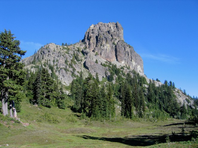
This section is gorgeous hiking. The trail winds, up and down, but never severe. Wildflower studded meadows, copses of alpine trees. The trail enters a glorious section of ridge hiking, that stays high and traverses towards Trap Lake. Trap Lake is shaded in the afternoon and was quite chilly as we stood high above it.

It became a joke, that still lives on. “What was wrong with Trap Lake??” It was supposed to be night 1 for camping at. It was getting late, but as we looked far down none of us wanted to climb down and freeze – even in early August. So we kept going, hoping we’d find a spot before it got dark. Well….as with all grand plans, it didn’t quite go as we wanted. We pulled up our strength and headed to the top of the ridge and headed over the back side. We hiked as fast as we could, passing Surprise Lake, and another small lake. By this point dusk was on us. We knew we were near Glacier Lake but we knew we would not see social trails for campsites there. In dwindling light we saw a wide area off the trail and we camped there for night 1. We were miles ahead but?

The start of Day 2 came early. Probably too early. Turned out our flat spot was by the head of this small lake as well. It was a pretty start though. We were up with dawn and on the trail. We passed Glacier Lake and had a laugh, finding out that had we had a few minutes more light, we might have made it.

The trail comes into an exposed boulder haven and you have two choices. Follow the PCT to the right-ish or take the old Cascade Crest Trail up the notch to Surprise Gap. (Yes, the PCT is better graded and more likely to be snow free, but if I had a choice again, I’d have taken the old way and saved a lot of time).

The trail winds through the boulders as it leaves the lake basin.

As it pulls up high, you do get a lot of views.

But the general focus is climbing till you get around the ridge. Then it gently traverses the ridge with lots of views. At least it is easy hiking, as you wander the ridge towards Deception Lakes.

We reached Deception Lakes well before Noon. This was supposed to be night 2. We took a lunch, some of us went swimming. And realized it was a bug filled meadow. None of us wanted to stay here, so we decided to push on. We passed Daisy Lake, then continued on in a ridge traverse.

As far as one can see, was a forest of dying or dead trees, all felled by the tiny beetle. A fire waiting to happen.
As we crossed Deception Pass (where Deception Creek trail comes up to from way down in the photo), we had the two creek crossings waiting for us farther down, both of which are not bridged. The trail to the crossings is easy going and you have changed what ridge you are hiking along. In a wide swath of open avalanche sits the creeks to cross.

The headwaters of the Cle Elum River was one of the crossings. This one had a log parked over it. I butt scooted it and nearly had a panic attack. But I made it.

The other crossing I put on sandals and walked through the crossing, it was to crotch height on me, but I was happier to cross it that way than to risk it on yet another “log” parked on rocks. I was exhausted mentally after the crossings, but I also knew I had nothing else to freak me out the rest of the trip. We headed uphill, yet again looking for somewhere to stop.
Day 3 came early once again. Our camp had been in a forested knoll, as the trail curved by. It was about the ugliest PCT campsite we could have dreamed up. But we were tired that day, and it did the job.
As with all days, it started uphill immediately. As we pulled up, we entered Cathedral Pass, which had a melt pond. Cathedral Rock was gorgeous. It would have been a great campsite, but we just didn’t have it in us to go that far that day.

Looking far down at Deep Lake. You know where this is going….Deep Lake was supposed to be Night 3’s campsite. Here it was 8 am maybe and we were looking down at it.

We were at the lake after a few knee crunching miles of down, down, down. We forded the tiny outlet creek and had lunch at the lake….well before Noon. With that, we pulled out the map and decided we’d have a “break day”. Yes, someone in the group actually said that. Because it was all downhill. Snort. We continued on, and followed Spinola Creek down, down and did I mention down? to Waptus Lake, a massive lake down deep (the lowest spot in Section J). We took a left just before the lake, towards the lake’s outlet stream. We knew there was horse camps on the other side.

At that time there was a massive bridge over the deep creek. I would not have forded this – we did it because we knew it was bridged that year. The other reason is we were deviating off the PCT for a bit.

The horse camps were plentiful and thanks to the jerks there the night before, we had a fire waiting for us. And free foil wrapped potatoes in it….Since it was a “break day” we got into camp long before dark and even fished. Break day. Sure.

Day 4 started. It was uphill from the first step out. Better early I suppose. Looking at Waptus Lake in the dark.
We were camped near Quick Creek, and took the trail uphill following it. Up and over it went, not much for switchbacks, this is an old school trail. We eventually came out near Pete Lake. Steve had wanted to avoid the long slog on the PCT by taking this trail. Coming down it was fun, as it was a slog of marble sized pebbles. Once we got to the bottom, at Pete Lake, the trail was a lot easier. It wasn’t PCT level however.

From there we worked our way back to the PCT following Lemah Creek, fording one creek along the way (it was cold, but not fast, and was easy to ford). Eventually we popped to a trail junction with the PCT and took a left to continue southbound.

We knew we were nearly to the next section of good stuff with a no fire sign. We were not far from Spectacle Lake. This was before the massive forest fire that cleared the trees.

Delate Creek and its waterfalls. The trail kept heading uphill, eventually we came to the turnoff for the lakes.

Taking a break at the falls and reading maps.

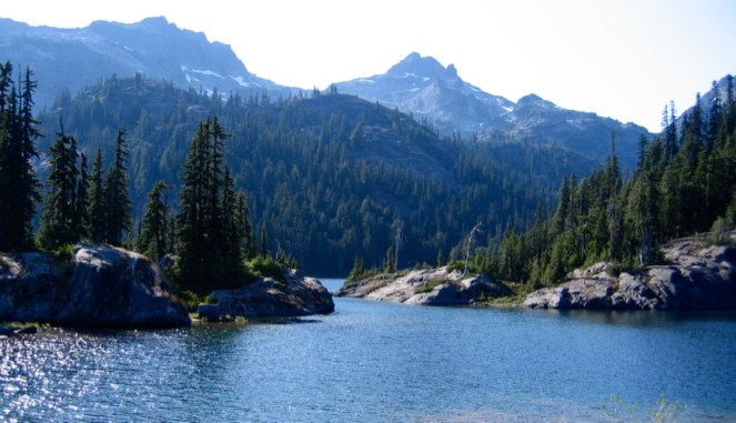
Spectacle Lakes were and are amazing. Huge lakes, surrounded by high peaks. With a ton of campsites. This would be our 4th night out.
We picked an amazing area and saw no one else out there.

The winds howled all day, but once the sun set, the winds stopped overnight.

For a few years I used the solo REI tent I called the escape pod (the 2 man version was the mother ship). It was tiny, but had a lot of room and I could sit up in it. It wasn’t freestanding however, so it was always tricky to set up if it was on rock. I was tired that night and slipped asleep quickly. Morning came early as my friend Dani (standing in the above photo), woke me up before dawn. We would see a sliver of light just cresting in the East. It was maybe 4 am. She wanted to hike bug free and in the cold. Couldn’t blame her. We were on the trail before the lake basin saw light.

The hike from the basin up was pure hiking gold. The early sun bathed us, and the miles went fast as we hiked up the ridge.

Looking far down at Spectacle.

Cresting the top of the ridge. The sun was almost there.

We entered Park Lakes, a collection of pretty subalpine lakes set in a hanging meadow.

It was a peaceful hike here, and it goes far too fast.

And then we were ready to start the climb up to the pass to start the Chikamin Traverse.

As we swung to the other side.
I took almost no photos. I focused on the miles of the traverse, looking ahead, not off to my side. The trail is narrow and full of pebbles. For me this was not an enjoyable section. It really got me with fear of heights. Since I didn’t take photos, the trail is up high, but below the ridge. You walk around the head of a bowl, if you will. There are no trees, and the trail sits cut out of the side, with 1000’s of feet below you.

Nearing the end of the traverse. Mount Rainier in the far distance, peeking up.

Finally we came to the end of the long traverse and there was ground to walk on. I was never so happy to pass Steve finally…..

Looking back.

Of course looking back it never looks as bad as the mind has you think it was.

Mount Rainier in the far distance, with I-90 down low. You could hear traffic sounds at times, in the wind, though we were many miles away.

I left everyone eating and set off to be by myself. I was feeling the trip and was out of sorts mentally. My Mother had passed away a few days before the trip, and the trip had given me a long time of quiet to think over the miles. As I worked my way down to a wide area I saw a herd of mountain goats.

Something about the goats clicked in me, and I knew I’d be OK.

The melt ponds were gone, but the goats were still there. This open area sits below Huckleberry Mountain. It has multiple ponds and many trails visible from above.

After I left the goats the trail wound around the ridges. It was subalpine bliss.

Joe Lake.

The hillsides were amazing here.

Ridge Lake. 7.5 miles to Snoqualmie Pass. I was ready to go home, though this was supposed to be our last night out on the trail. I had camped here years before, at Gravel Lake (which is on the other side of the trail). I was behind everyone, which wasn’t uncommon. I am short, with short legs, so I hike my hike. I caught up to them taking a break. I decided I was hiking out that day. I had called Kirk, from high on Huckleberry Mountain and got a call through.
The hike from here to Kendall Katwalk is through pleasant hillsides and meadowy areas. It goes fast.

Kendall Katwalk. It had been years since I was there, and it is so different late in the day, almost foreboding. I was running low on time and the sun was dipping. The hike was quiet as I quickly lost elevation, dropping down into the trees. At some point, I passed Scott Williams on his yo-yo PCT hike. I was so deeply in thought with my mind that as a man passed me, heading North, late in the day, while I thought it odd I pushed it away. Wasn’t till later that Steve asked me had I passed Scott. Oops.
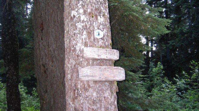
The trailhead for those going North. Showing Stevens Pass and Commonwealth Basin. And with that I was nearly to the parking lot and a waiting husband to pick me up. It was a 19+ mile day and I was done.
~Sarah